


Dzongkhag profile
Vision:
Towards thrilling Trashigang
Missions:
- Entrepreneurial mindset
- Result oriented
- Sustained efforts
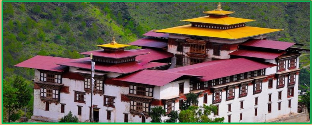
Brief History of Trashigang Dzong
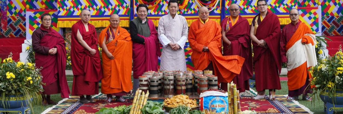
The fortress was built in 1659 at top of edge with steep cliffs on three sides, overlooking the Drangme Chhu and Gamri Chhu rivers. The construction of the Dzong was prophesied by Zhabdrung Ngawang Namgyal who ordered the Penlop (Governor) of Trongsa, Chhogyal Minjur Tampa to put down local chieftains and construct the Dzong. According to legend, the sight of the Dzong scared the invading Tibetan army which retreated while remarking that the Dzong was a " (Nam Dzong) Sky Fortress and was not on the ground". The Dzong was further expanded by Gyalsey Tenzin Rabgye between 1680 and 1694 and by Dzongpon Dopola in 1936. The Dzong was consecrated and named as Trashigang by Dudjom Jigdral Yeshe Dorje. After the 1962 Sino-Indian War, Bhutan allowed Indian soldiers returning home to pass through Eastern Bhutan. However they were required to deposit their rifles at the armory in the Dzong, and proceed through Bhutan unarmed. The rifles lies in the Dzong even today. The Dzong celebrates the four day long Trashigang Tshechu festival every year, with people of fifteen Gewogs.
Dzongkhag Administration, Trashigang
Trashigang Dzongkhag shares its border with Mongar Dzongkhag to the west, Samdrup Jongkhar and Pemagatshel Dzongkhag to the South, TrashiYangtse Dzongkhag to the north and Indian state of Arunachal Pradesh to the east. Trashigang is 551 km away from Thimphu, the capital city and is one of the largest Dzongkhags in the Kingdom. The Dangmechu, one of the largest rivers in the country passes through the Dzongkhag. The altitude elevation ranges from 600 m to over 4500 m above sea level. The climate is mainly temperate with an annual rainfall between 1000 mm and 2000 mm. The lowest human settlement is found at an altitude of 550 m above sea level at Deno of Lumang Gewog and the highest at Merak at an altitude of 4600 m above sea level.
Highlights:
- Total Area : 3066 (2017) Square kilometers
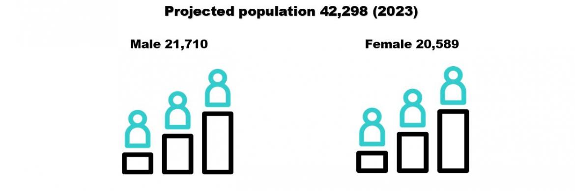
- Population (2017 PCBH) : 45,518
- Total Households. : 10,720
- Forest cover : 77.87
- Density of population : 20.64 per sq.km
- Arable land : 3.64 percent
The Dzongkhag Administration Headquarters and the main town are located at Mithidrang, which falls under Samkhar Gewog. The Dzong is used as the Dzongkhag Headquarters and also as the seat of Dzongkhag Rabdhey.
The Dzongkhag is administratively divided into three Dungkhags, 15 Gewogs and 79 Chiwogs including a Thromde. All the Gewogs are connected with motorable roads.